
 Continue with onX Maps
 Sign in with Facebook


 Particularly Special Place


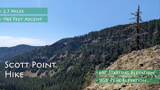
 Intermediate/Difficult
Intermediate/Difficult
Intermediate/Difficult
 Intermediate/Difficult
 Wahkeena Falls-Devil's Rest-Angel's Rest Loop
8.7 mi 14.1 km • 2,859' Up 871.49 m Up • 2,857' Down 870.76 m Down

 Bridal…, OR
 Munra Point Out and Back
6.2 mi 10.0 km • 2,173' Up 662.39 m Up • 2,205' Down 672.21 m Down
Cascade…, OR
 Beacon Rock Summit Trail
0.8 mi 1.3 km • 555' Up 169.25 m Up • 550' Down 167.63 m Down
Stevenson, WA
Angel's Rest Lookout
4.1 mi 6.6 km • 1,441' Up 439.21 m Up • 1,439' Down 438.72 m Down
Bridal…, OR
Eagle Creek Trail to Tunnel Falls
11.7 mi 18.8 km • 1,280' Up 390.28 m Up • 1,280' Down 390.29 m Down
Cascade…, OR
PCT: Herman Creek to Eagle Benson
18.1 mi 29.1 km • 4,399' Up 1340.93 m Up • 4,399' Down 1340.8 m Down
Cascade…, OR


0 Comments