
 Continue with onX Maps
 Continue with Facebook


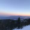
 Particularly Special Place


 Difficult
Difficult
Difficult
 Difficult
Land Manager: USFS - San Bernardino National Forest Office
 Big Bear - Champion Lodgepole Pine & Bluff Lake
0.5 mi 0.9 km • 3' Up 1.04 m Up • 97' Down 29.61 m Down

 Zanja Peak Out-and-Back
4.8 mi 7.7 km • 1,020' Up 310.91 m Up • 1,020' Down 310.98 m Down

 Hi-View Nature Trail
1.3 mi 2.1 km • 312' Up 95 m Up • 313' Down 95.54 m Down
Yucca V…, CA
 San Jacinto Peak Loop
22.5 mi 36.2 km • 6,228' Up 1898.26 m Up • 6,231' Down 1899.06 m Down
Idyllwi…, CA
Deep Creek Hot Springs Trail
3.7 mi 5.9 km • 917' Up 279.35 m Up • 917' Down 279.46 m Down
Lake Ar…, CA
Cactus to Clouds: Palm Springs - Mt. San Jacinto
14.4 mi 23.3 km • 10,444' Up 3183.21 m Up • 172' Down 52.29 m Down
Palm Sp…, CA


0 Comments