
 Continue with onX Maps
 Continue with Facebook


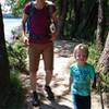
 Particularly Special Place


 Easy
Easy

 Easy
Easy
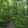
 Birkhead Mountain Wilderness Loop
9.8 mi 15.8 km • 995' Up 303.34 m Up • 995' Down 303.35 m Down
 Southwest Park Loop
2.2 mi 3.6 km • 203' Up 61.82 m Up • 212' Down 64.62 m Down
Cane Creek Mountains Full Tour
3.7 mi 5.9 km • 386' Up 117.56 m Up • 385' Down 117.23 m Down
Snowcamp, NC
Cedarock Park Tour
7.1 mi 11.4 km • 458' Up 139.55 m Up • 460' Down 140.09 m Down
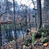
Badin Lake Trail #94
5.4 mi 8.7 km • 226' Up 68.76 m Up • 226' Down 68.9 m Down
Fall Mountain Trail
4.2 mi 6.8 km • 545' Up 166.01 m Up • 546' Down 166.47 m Down


0 Comments