
 Continue with onX Maps
 Continue with Facebook


 Particularly Special Place


 Intermediate

 Intermediate
Land Manager: USFS - Cherokee National Forest Office
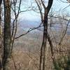
 Benton MacKaye Trail - Childers Creek to Unicoi Gap - Backpack
19.1 mi 30.7 km • 3,552' Up 1082.62 m Up • 2,302' Down 701.76 m Down
Benton, TN
Hickory Creek to Panther Creek Falls
10.3 mi 16.5 km • 1,677' Up 511.05 m Up • 1,677' Down 511.09 m Down
 Chatsworth, GA
Weaver Creek to Rocky Mountain
Chatsworth, GA
Weaver Creek to Rocky Mountain
6.7 mi 10.8 km • 1,525' Up 464.71 m Up • 1,525' Down 464.68 m Down
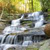
 Conasauga Falls Trail #170
1.3 mi 2.1 km • 288' Up 87.93 m Up • 289' Down 88.14 m Down
Emery Creek Falls
5.9 mi 9.5 km • 690' Up 210.17 m Up • 689' Down 209.99 m Down
Chatsworth, GA
Fall Branch Falls Out-and-Back
0.9 mi 1.5 km • 207' Up 63.23 m Up • 206' Down 62.66 m Down
Cherry Log, GA


0 Comments