
 Continue with onX Maps
 Continue with Facebook


 Particularly Special Place


 Intermediate/Difficult
Intermediate/Difficult
Intermediate/Difficult
 Intermediate/Difficult
Land Manager: City of Saugatuck
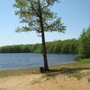
 Saugatuck Harbor Natural Area
2.9 mi 4.7 km • 74' Up 22.7 m Up • 74' Down 22.65 m Down
 Douglas, MI
 Mount Baldhead Figure Eight
1.6 mi 2.5 km • 176' Up 53.66 m Up • 247' Down 75.19 m Down
Douglas, MI
 Saugatuck Dunes Figure-Eight
5.9 mi 9.4 km • 588' Up 179.31 m Up • 588' Down 179.32 m Down
White Trail Loop
2.0 mi 3.2 km • 232' Up 70.69 m Up • 232' Down 70.66 m Down
Wakazoo Loop
14.5 mi 23.3 km • 898' Up 273.59 m Up • 898' Down 273.72 m Down
 Allegan, MI
Aman Park Hike
Allegan, MI
Aman Park Hike
3.6 mi 5.8 km • 380' Up 115.73 m Up • 376' Down 114.6 m Down
Walker, MI


0 Comments