Hiking Project Logo

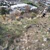
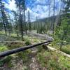
A steep climb up the south face of University Mountain.


Your Rating: Rating Rating Rating Rating Rating      Clear Rating
Your Difficulty:
Your Favorites: Add To-Do · Your List
Zoom in to see details
Map Key

0.8

Miles

1.3

KM

Point to Point

5,113' 1,558 m

High

4,358' 1,328 m

Low

755' 230 m

Up

0' 0 m

Down

18%

Avg Grade (10°)

29%

Max Grade (16°)

Dogs Leashed

Features Birding · Views · Wildflowers · Wildlife

Need to Know

This is black bear and mountain lion territory- always carry bear spray!

Description

Follow this steep route from the fire road located just north of the Meadow Loop Trail #19.2 up to an intersection with Forest Road #19241. There is a frequented trail that continues up the ridegeline at this trail's end, but it is not maintained by the USFS.

Road #19241 can be followed eastward to the intersection of Forest Road #449, which can then be followed south back toward the main trail system or north to the radio towers at the peak adjacent to University Mountain.

Flora & Fauna

Birds, small mammals, deer

Contacts

Shared By:

McCaide Wooten

Trail Ratings

  4.0 from 1 vote

#21615

Overall
  4.0 from 1 vote
5 Star
0%
4 Star
100%
3 Star
0%
2 Star
0%
1 Star
0%
Trail Rankings

#492

in Montana

#21,615

Overall
2 Views Last Month
15 Since Nov 29, 2020
Difficult Difficult

0%
0%
0%
0%
100%
0%

0 Comments

Weather


Current Trail Conditions

Unknown
Add Your Check-In

Check-Ins

none
Welcome

Join the Community! It's FREE

Already have an account? Login to close this notice.