
 Continue with onX Maps
 Continue with Facebook


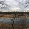
 Particularly Special Place


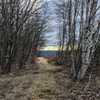
 Intermediate

 Intermediate
Local Club: Williamsburg Conservation Commission
 Arcadia Walking Loop (No Running Allowed)
0.8 mi 1.4 km • 25' Up 7.7 m Up • 25' Down 7.63 m Down
 Sanderson Brook Falls Trail
2.0 mi 3.2 km • 238' Up 72.54 m Up • 239' Down 72.79 m Down
 Robert Frost Trail
40.2 mi 64.7 km • 5,360' Up 1633.58 m Up • 5,892' Down 1795.84 m Down
Wendell, MA
Leyden Blueberry Fields
7.5 mi 12.1 km • 1,167' Up 355.66 m Up • 1,188' Down 362.11 m Down
Bernard…, MA
Northfield Mountain Trails
11.3 mi 18.3 km • 1,913' Up 583.11 m Up • 1,912' Down 582.9 m Down
Mount Greylock Summit Loop
6.6 mi 10.7 km • 2,251' Up 686.23 m Up • 2,246' Down 684.66 m Down
 Adams, MA


0 Comments