Hiking Project Logo

One of the easier hikes within the Belknap Range.


Your Rating: Rating Rating Rating Rating Rating      Clear Rating
Your Difficulty:
Your Favorites: Add To-Do · Your List
Zoom in to see details
Map Key

1.5

Miles

2.5

KM

Point to Point

1,660' 506 m

High

1,077' 328 m

Low

687' 209 m

Up

104' 32 m

Down

10%

Avg Grade (6°)

25%

Max Grade (14°)

Dogs Unknown

Features Fall Colors · Views

Family Friendly Generally an easy climb for nice views.

Description

Whiteface Trail is one of the easier hikes in the Belknap Range. From Belknap Mountain Road it takes you to the summit of Whiteface Mountain via a generally moderate trail. The majority of this trail is wide, mostly doubletrack, if not slightly narrower. Note that about a mile of this trail is shared with a Jeep/ATV trail that is on occasion used by vehicles.

The trail begins from the end of Belknap Mountain Road. There is a small parking area at the end of the paved portion of the road and then cars typically spill over onto one side of the road. Travel a short distance down the dirt road past one house on the left, the trail begins on the left before you reach the second house.

As of October 2020 the trail was generally well maintained, easy to follow and marked by blue blazes.

The trail immediately starts to climb at a moderate pace roughly the same moderate climb until meeting up with the Piper-Whiteface Link Trail, about 0.7 miles from where you started.

As you continue along after passing the Piper-Whiteface Link trailhead the trail narrows up a bit before widening again in a grassy clearing just a few hundred feet ahead. At this point you meet up with the Jeep/ATV trail and the trail remains a wide doubletrack all the way to the summit. The trail also mostly levels out until a steeper climb just before the summit.

At about 1.25 you'll reach that steeper climb, when you reach the top of it you'll have solid view west and partial views north, particularly of Piper Mountain. This viewpoint is at about 1.4 miles or so, you'll find these are the best views. Continue another tenth of a mile or so to the summit.

Also note: Hiking Project shows this trail at just under 700 ft of elevation gain, it's more like 550 actually hiking it.

Contacts

Shared By:

Marshall Bronfin

Trail Ratings

  4.0 from 1 vote

#2

in Laconia

#15460

Overall
  4.0 from 1 vote
5 Star
0%
4 Star
100%
3 Star
0%
2 Star
0%
1 Star
0%
Trail Rankings

#2

in Laconia

#347

in New Hampshire

#15,460

Overall
7 Views Last Month
408 Since Oct 24, 2020
Intermediate Intermediate

0%
50%
50%
0%
0%
0%

Photos

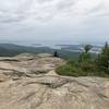
Looking North from Summit
Mar 8, 2021 near Gilford, NH

0 Comments

Weather


Current Trail Conditions

Unknown
Add Your Check-In

Check-Ins

Jun 10, 2021
Mike Lavelle
May 14, 2021
Mike Lavelle
Apr 10, 2021
Mike Lavelle
Mar 8, 2021
Mike Lavelle
Great views for a short hike! 3.8mi
Welcome

Join the Community

Create your FREE account today!
Already have an account? Login to close this notice.

Get Started