Hiking Project Logo

A trail that tours the confluences that create the Eno River.


Your Rating: Rating Rating Rating Rating Rating      Clear Rating
Your Difficulty:
Your Favorites: Add To-Do · Your List
Zoom in to see details
Map Key

2.1

Miles

3.3

KM

Loop

614' 187 m

High

568' 173 m

Low

97' 30 m

Up

98' 30 m

Down

2%

Avg Grade (1°)

8%

Max Grade (4°)

Dogs Leashed

Features Birding · Fall Colors · Fishing · River/Creek · Wildflowers

Description

This trail is on the tongue of land between the West and East Forks of the Eno River. Most of the trail mirrors one of these two forks and rolls up and down between the lowlands and the hills along the creek.

The lowlands are full of Carolina Spicebush, while the higher country is a mix of hardwoods with a few pine trees. Spotted along the trail are access points to be able to get down to the water and fish.

Running through the center of the trail is are a couple of meadows that provide the bigger views of the landscape.

Contacts

Land Manager: Eno River Association
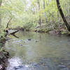
Shared By:

Russell Hobart

Trail Ratings

  3.0 from 1 vote

#32214

Overall
  3.0 from 1 vote
5 Star
0%
4 Star
0%
3 Star
100%
2 Star
0%
1 Star
0%
Trail Rankings

#1,332

in North Carolina

#32,214

Overall
3 Views Last Month
99 Since Oct 10, 2020
Intermediate Intermediate

0%
0%
100%
0%
0%
0%

Photos

Clean trail through the an field.
Oct 10, 2020 near Hillsbo…, NC
Mushrooms are ready to explode
Oct 10, 2020 near Hillsbo…, NC
The confluence of the Eno River.
Oct 10, 2020 near Hillsbo…, NC
Mature trees rising above the trail.
Oct 10, 2020 near Hillsbo…, NC

0 Comments

Weather


Current Trail Conditions

Unknown
Add Your Check-In

Check-Ins

none
Welcome

Join the Community

Create your FREE account today!
Already have an account? Login to close this notice.

Get Started