
 Mt. Tammany Summit
3.4 mi 5.5 km • 1,151' Up 350.73 m Up • 1,182' Down 360.36 m Down

 Strouds…, PA
 Mount Minsi Loop
5.2 mi 8.3 km • 1,021' Up 311.1 m Up • 1,021' Down 311.13 m Down
Orchard/Hamilton/Pioneer Loop
6.4 mi 10.3 km • 682' Up 207.74 m Up • 698' Down 212.9 m Down
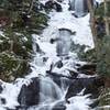
Buttermilk Falls, Crater Lake, and Hemlock Pond Loop
7.2 mi 11.6 km • 1,301' Up 396.67 m Up • 1,301' Down 396.54 m Down
Point Mountain Reservation - North to South
6.4 mi 10.4 km • 1,383' Up 421.62 m Up • 1,071' Down 326.5 m Down
Point Mountain Loop
2.9 mi 4.7 km • 559' Up 170.42 m Up • 562' Down 171.28 m Down

 Continue with onX Maps
 Continue with Facebook


 Particularly Special Place


0 Comments