
 Continue with onX Maps
 Continue with Facebook


 Particularly Special Place


 Easy
Easy


 Easy
Easy
Land Manager: Asheville NC, Parks and Recreation
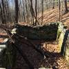
 Richmond Hill Park Trails
4.1 mi 6.6 km • 412' Up 125.6 m Up • 420' Down 127.95 m Down
 MST/Powhatan Loop
9.9 mi 16.0 km • 1,274' Up 388.4 m Up • 1,302' Down 396.77 m Down
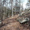
Rattlesnake Lodge Loop
4.0 mi 6.5 km • 847' Up 258.17 m Up • 847' Down 258.18 m Down
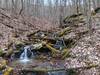
Mills River Loop
3.6 mi 5.8 km • 315' Up 96.13 m Up • 332' Down 101.06 m Down
 Art Loeb & North Slope Loop
7.4 mi 11.8 km • 1,330' Up 405.5 m Up • 1,329' Down 405.11 m Down
Full CM Gamelands Loop
12.2 mi 19.6 km • 3,002' Up 915.06 m Up • 2,998' Down 913.91 m Down


0 Comments