
 Continue with onX Maps
 Continue with Facebook


 Particularly Special Place


 Difficult
Difficult
Difficult
 Difficult
 Mt. Cutler Loop
2.6 mi 4.2 km • 776' Up 236.67 m Up • 794' Down 241.99 m Down

 Mt. Chocorua - Piper Trail
8.0 mi 12.9 km • 2,614' Up 796.79 m Up • 2,614' Down 796.73 m Down
 Madison, NH
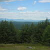
 Black Cap Trail
2.5 mi 4.0 km • 590' Up 179.92 m Up • 589' Down 179.53 m Down
North C…, NH
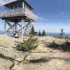
Mount Kearsarge North Trail
5.8 mi 9.4 km • 2,485' Up 757.4 m Up • 2,487' Down 758.04 m Down
North C…, NH
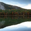
 Echo Lake Trail
0.9 mi 1.5 km • 94' Up 28.6 m Up • 94' Down 28.78 m Down
North C…, NH
Mt. Chocorua - Champney Falls Route
7.2 mi 11.5 km • 2,162' Up 659.05 m Up • 2,163' Down 659.27 m Down
Ferncroft, NH


0 Comments