
 Continue with onX Maps
 Continue with Facebook


 Particularly Special Place


 Difficult
Difficult
Difficult
 Difficult
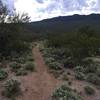
 Rincon Peak
14.4 mi 23.2 km • 4,288' Up 1306.93 m Up • 4,288' Down 1306.92 m Down
 Mescal, AZ
 Florida Canyon Trail #145
8.8 mi 14.1 km • 3,466' Up 1056.56 m Up • 3,466' Down 1056.36 m Down
 Bridal Wreath Falls
5.8 mi 9.4 km • 1,066' Up 325 m Up • 1,066' Down 324.96 m Down
Bridal Wreath Falls Loop
7.3 mi 11.8 km • 1,155' Up 351.95 m Up • 1,154' Down 351.64 m Down
 Wildhorse to Douglas Springs Loop
3.1 mi 4.9 km • 157' Up 47.95 m Up • 152' Down 46.19 m Down
 Mica View - Cactus Forest Mini Loop
2.1 mi 3.4 km • 94' Up 28.72 m Up • 93' Down 28.49 m Down


1 Comment