
Land Manager: Town of Lexington, MA - Conservation
 Whipple Hill Loop
2.4 mi 3.8 km • 214' Up 65.25 m Up • 213' Down 65.06 m Down


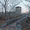
 Wright's Tower Out-and-Back
0.9 mi 1.5 km • 138' Up 42 m Up • 137' Down 41.88 m Down
Medford, MA
Virginia Woods Loop
0.9 mi 1.5 km • 117' Up 35.64 m Up • 118' Down 35.9 m Down
Lynn Woods Loop
7.0 mi 11.2 km • 543' Up 165.53 m Up • 541' Down 164.95 m Down
South P…, MA
Boston Hill Loop
3.1 mi 5.1 km • 428' Up 130.56 m Up • 425' Down 129.42 m Down
 Blue Hills Loop
4.1 mi 6.5 km • 1,171' Up 356.87 m Up • 1,165' Down 355.22 m Down
Dedham, MA

 Continue with onX Maps
 Continue with Facebook


 Particularly Special Place


0 Comments