
Local Club: Bay Area Ridge Trail Council
Jun 6, 2023: 2023 Ridge Trail Challenge
Jun 6, 2023: Accessible Adventure: Penitencia Creek
Jun 6, 2023: 21st Anniversary East Bay Hills Hike & Ride
 Rocky Ridge and Alpine Lake
4.9 mi 7.9 km • 790' Up 240.94 m Up • 791' Down 241.02 m Down
 Barnabe Peak Out and Back
4.4 mi 7.0 km • 1,279' Up 389.71 m Up • 1,279' Down 389.81 m Down
 Phoenix Lake Loop
6.2 mi 9.9 km • 741' Up 225.73 m Up • 742' Down 226.08 m Down
Rabbit Chase 30K
19.6 mi 31.6 km • 3,673' Up 1119.51 m Up • 3,669' Down 1118.41 m Down
 Bolinas, CA
 Hillside Loop
2.5 mi 3.9 km • 255' Up 77.77 m Up • 255' Down 77.75 m Down
Tamalpa…, CA
Laguna and Coast Loop
5.1 mi 8.2 km • 362' Up 110.37 m Up • 348' Down 106.19 m Down

 Continue with onX Maps
 Continue with Facebook


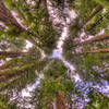
 Particularly Special Place


0 Comments