
 Continue with onX Maps
 Continue with Facebook


 Particularly Special Place


 Intermediate
Intermediate
Intermediate
 Intermediate
Land Manager: Maryland DNR - Patapsco State Park
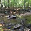
 Soapstone, Santee Branch, Bull Run Loop
2.7 mi 4.4 km • 436' Up 132.84 m Up • 425' Down 129.65 m Down
 Morning Choice and Rockburn Branch
4.4 mi 7.1 km • 325' Up 99.16 m Up • 325' Down 99.15 m Down
Oregon Ridge Logger Trail Loop
2.5 mi 4.1 km • 291' Up 88.83 m Up • 296' Down 90.31 m Down
 Hunt Va…, MD
Merryman Trail
Hunt Va…, MD
Merryman Trail
8.8 mi 14.1 km • 918' Up 279.84 m Up • 918' Down 279.79 m Down
 Paper Mill Road Trails at NCR
4.1 mi 6.5 km • 277' Up 84.54 m Up • 277' Down 84.31 m Down
 Timber Ridge/Tobacco Barn to Pine Grove Loop
5.4 mi 8.7 km • 483' Up 147.14 m Up • 481' Down 146.76 m Down


0 Comments