
Local Club: Bay Area Ridge Trail Council
Jun 6, 2023: 2023 Ridge Trail Challenge
Jun 6, 2023: Accessible Adventure: Penitencia Creek
Jun 6, 2023: 21st Anniversary East Bay Hills Hike & Ride
Land Manager: California State Parks - Benicia State Recreation Area
 Tilden Park Loop
4.4 mi 7.1 km • 864' Up 263.36 m Up • 864' Down 263.34 m Down

 Kensington, CA
Rim Trail
Kensington, CA
Rim Trail
5.2 mi 8.3 km • 903' Up 275.09 m Up • 901' Down 274.55 m Down
Lafayette, CA
Temescal Loop
2.0 mi 3.2 km • 109' Up 33.32 m Up • 110' Down 33.42 m Down
 Richmond Marina Bay Trail
8.1 mi 13.0 km • 23' Up 7.07 m Up • 23' Down 7.05 m Down
El Cerrito, CA
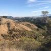
Ohlone-Crystyl Ranch Loop
5.5 mi 8.9 km • 734' Up 223.87 m Up • 747' Down 227.67 m Down
 Stream Trail Out-and-Back
1.7 mi 2.7 km • 80' Up 24.38 m Up • 80' Down 24.29 m Down
Moraga, CA

 Continue with onX Maps
 Continue with Facebook


 Particularly Special Place


0 Comments