
 Continue with onX Maps
 Continue with Facebook


 Particularly Special Place


 Easy
Easy
Easy
Easy
 Easy
Easy
Local Club: Bay Area Ridge Trail Council
Jun 6, 2023: 2023 Ridge Trail Challenge
Jun 6, 2023: Accessible Adventure: Penitencia Creek
Jun 6, 2023: 21st Anniversary East Bay Hills Hike & Ride
 Peace Circle: Wildcat Peak from Little Farm
4.0 mi 6.4 km • 666' Up 202.96 m Up • 664' Down 202.39 m Down
 Kensington, CA
Briones Reservoir Loop Trail
Kensington, CA
Briones Reservoir Loop Trail
13.4 mi 21.6 km • 1,081' Up 329.57 m Up • 1,087' Down 331.3 m Down
 Berkeley Hills
3.5 mi 5.6 km • 995' Up 303.32 m Up • 161' Down 49.05 m Down
 Berkeley, CA
Temescal Loop
Berkeley, CA
Temescal Loop
2.0 mi 3.2 km • 109' Up 33.32 m Up • 110' Down 33.42 m Down
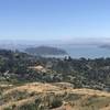
Ring Mountain Loop
2.9 mi 4.6 km • 584' Up 177.96 m Up • 584' Down 178.07 m Down
Corte M…, CA
Mt. Livermore Summit - North Ridge Trail
4.3 mi 6.9 km • 784' Up 239.03 m Up • 783' Down 238.68 m Down
Tiburon, CA


0 Comments