
Land Manager: USFS - Gallatin National Forest Office
 Sypes Canyon Trail
6.4 mi 10.3 km • 1,599' Up 487.52 m Up • 1,599' Down 487.36 m Down

 Bozeman, MT
Bozeman "M" Out-and-Back
Bozeman, MT
Bozeman "M" Out-and-Back
1.9 mi 3.1 km • 811' Up 247.05 m Up • 810' Down 246.89 m Down
 Baldy Mountain
10.9 mi 17.6 km • 3,837' Up 1169.65 m Up • 3,837' Down 1169.42 m Down
 North Cottonwood Loop
3.6 mi 5.9 km • 872' Up 265.81 m Up • 871' Down 265.5 m Down
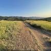
Triple Tree Trail
5.6 mi 9.1 km • 906' Up 276.15 m Up • 906' Down 276.15 m Down
Bozeman, MT
 Sourdough Canyon (Bozeman Creek Trail)
3.8 mi 6.1 km • 268' Up 81.61 m Up • 268' Down 81.64 m Down
Bozeman, MT

 Continue with onX Maps
 Continue with Facebook


 Particularly Special Place


0 Comments