
 Continue with onX Maps
 Continue with Facebook


 Particularly Special Place


 Intermediate/Difficult


 Intermediate/Difficult
Land Manager: Pacifica Land Trust
 Sweeny Ridge Loop
5.7 mi 9.1 km • 954' Up 290.82 m Up • 958' Down 292.09 m Down
Mussel Rock Park Tour
2.2 mi 3.6 km • 310' Up 94.64 m Up • 310' Down 94.47 m Down
Broadmoor, CA
 Coastal Trail: Lands End
2.9 mi 4.6 km • 192' Up 58.44 m Up • 192' Down 58.4 m Down
San Fra…, CA
 SF Crosstown Trail Route
16.9 mi 27.2 km • 1,993' Up 607.53 m Up • 1,856' Down 565.62 m Down
Brisbane, CA
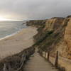
Cowell Ranch Beach
1.1 mi 1.8 km • 82' Up 25.09 m Up • 83' Down 25.18 m Down
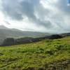
Tennessee Valley: Ridge Trail to Coast Loop
5.4 mi 8.7 km • 924' Up 281.5 m Up • 936' Down 285.36 m Down
Tamalpa…, CA


0 Comments