
 Continue with onX Maps
 Continue with Facebook


 Particularly Special Place


 Intermediate
Intermediate
Intermediate
 Intermediate
Land Manager: USFS - Coconino National Forest Office
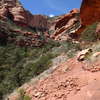
 Sycamore Basin Trail Out and Back
10.4 mi 16.7 km • 953' Up 290.41 m Up • 953' Down 290.46 m Down

 West Se…, AZ
 Fay Canyon Trail
2.8 mi 4.5 km • 463' Up 141.27 m Up • 463' Down 141.23 m Down
West Se…, AZ
Chuckwagon—Brins Mesa
5.7 mi 9.2 km • 723' Up 220.35 m Up • 695' Down 211.97 m Down
West Se…, AZ
Mescal Mountain Loop
4.7 mi 7.6 km • 369' Up 112.59 m Up • 369' Down 112.34 m Down
West Se…, AZ
Devil's Bridge Trail
4.0 mi 6.5 km • 528' Up 160.93 m Up • 523' Down 159.27 m Down
West Se…, AZ
West Fork of Oak Creek Trail
6.5 mi 10.4 km • 676' Up 205.98 m Up • 676' Down 206.08 m Down
Sedona, AZ


0 Comments