
 Continue with onX Maps
 Continue with Facebook


 Particularly Special Place


 Intermediate
Intermediate
Intermediate
 Intermediate
Local Club: Redding Land Trust
Land Manager: Town of Redding, CT
 Merestead County Park
4.6 mi 7.4 km • 680' Up 207.4 m Up • 689' Down 209.92 m Down

 Yellow Loop/Nature Trail
3.7 mi 5.9 km • 226' Up 68.86 m Up • 233' Down 71.04 m Down
Riverside, CT
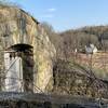
 West Rock Ridge Loop
7.9 mi 12.7 km • 785' Up 239.13 m Up • 772' Down 235.3 m Down
 New Haven, CT
Mount Nimham Fire Tower
New Haven, CT
Mount Nimham Fire Tower
1.4 mi 2.3 km • 326' Up 99.5 m Up • 326' Down 99.47 m Down
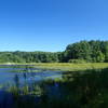
Lake Wintergreen Loop
1.6 mi 2.6 km • 94' Up 28.63 m Up • 89' Down 27.02 m Down
Woodbridge, CT
Three Lakes Trail - Appalachian Trail Loop
8.0 mi 12.8 km • 1,489' Up 453.77 m Up • 1,493' Down 455.16 m Down
Brincke…, NY


0 Comments