Dogs Unknown

Features
Birding · Views · Wildlife
Need to Know
There is no public parking. The most common parking place is at Don Juan's place. As of January 2018, the charge was Q30. Then, the municipality charges at the gate Q25 for Guatemalans and Q50 for foreigners. The use of a guide is highly recommended. You can ask Juan (parking place) to arrange one for you.
Description
The trail is a 4 hour hike to the basecamp. You still need another hour to reach the summit, which is at 3,976 meters.
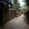
The three stages of the route are from town to the gate, gate to the barrel, and barrel to the terraces (basecamp). The first stage starts with a steep section through the cornfield, then it ends with Raíces (roots in Spanish) which are several steps that culminate with the gate. Here, you have restroom and have to pay the entrance fee (GUA: Q25, Foreigners: Q50). Hiring a local guide is highly recommended, although most of them speak only Spanish.
The second stage is through the misty forest, the trail is still steep, but the lush vegetation makes more enjoyable the effort. At the middle of the stage, you enter a vehicle road which you have to continue going up until you reach the end of the road, which has a barrel as a barrier.
The last stage is the easiest as you have a more moderate climb through the dry pines and the tall grasses. Finally, you reach the basecamp. If you plan to camp, here is your best spot as you have first line to watch the Fuego Volcano Eruptions.
Shared By:
Ignacio Basterrechea

 Continue with onX Maps
 Continue with Facebook


 Particularly Special Place


 Difficult


1 Comment