
 Continue with onX Maps
 Continue with Facebook


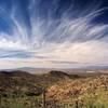
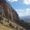
 Particularly Special Place


 Easy/Intermediate
Easy/Intermediate
Easy/Intermediate
 Easy/Intermediate
Land Manager: NPS - Saguaro National Park
 Wasson Peak Summit
9.4 mi 15.1 km • 2,113' Up 644.1 m Up • 2,113' Down 644.01 m Down

 Flowing…, AZ
Brown Mountain
Flowing…, AZ
Brown Mountain
4.9 mi 7.9 km • 909' Up 277.1 m Up • 909' Down 277.04 m Down
Tucson…, AZ
 Mount Kimball Out-and-Back
8.7 mi 14.0 km • 4,125' Up 1257.22 m Up • 4,124' Down 1256.97 m Down
Catalin…, AZ
Bear Canyon Loop
16.9 mi 27.2 km • 2,465' Up 751.48 m Up • 2,456' Down 748.6 m Down
Catalin…, AZ
 Honeybee Canyon Short Loop
12.3 mi 19.9 km • 456' Up 139.11 m Up • 457' Down 139.31 m Down
Catalina, AZ
 Canyon Loop via Horse Trail
3.1 mi 5.0 km • 285' Up 86.8 m Up • 286' Down 87.2 m Down


 All Clear


0 Comments