
 Continue with onX Maps
 Continue with Facebook


 Particularly Special Place


 Intermediate/Difficult
Intermediate/Difficult
Intermediate/Difficult
 Intermediate/Difficult
Land Manager: USFS - Gifford Pinchot National Forest Office
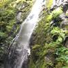
 Tarbell Trail to Hidden Falls
10.4 mi 16.7 km • 1,394' Up 424.96 m Up • 1,394' Down 424.97 m Down
 Cape Horn Loop
6.7 mi 10.9 km • 1,344' Up 409.8 m Up • 1,345' Down 409.89 m Down
 Latourell Falls
2.3 mi 3.7 km • 654' Up 199.46 m Up • 686' Down 209.02 m Down
 Bridal…, OR
Oxbow Highlights
Bridal…, OR
Oxbow Highlights
5.5 mi 8.8 km • 447' Up 136.37 m Up • 451' Down 137.48 m Down
Trapper Creek Out-and-Back
7.6 mi 12.3 km • 1,704' Up 519.52 m Up • 1,704' Down 519.49 m Down
Stevenson, WA
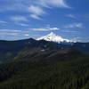
 PCT: Herman Creek to Eagle Benson
18.1 mi 29.1 km • 4,399' Up 1340.93 m Up • 4,399' Down 1340.8 m Down
Cascade…, OR


0 Comments