
 Continue with onX Maps
 Continue with Facebook


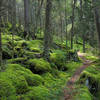
 Particularly Special Place


 Difficult
Difficult
Difficult
 Difficult
Local Club: Benton MacKaye Trail Association
Land Manager: NPS - Great Smoky Mountains National Park
 Mt. Cammerer from Low Gap
10.8 mi 17.4 km • 2,848' Up 867.98 m Up • 2,847' Down 867.91 m Down

 Newport, TN
 Hen Wallow Falls
4.5 mi 7.2 km • 855' Up 260.74 m Up • 855' Down 260.48 m Down
Newport, TN
Ramsey Cascades Trail
8.0 mi 12.8 km • 2,209' Up 673.28 m Up • 2,208' Down 673.1 m Down
Gatlinburg, TN
Alum Cave - Cliff Top Out and Back
10.7 mi 17.3 km • 2,773' Up 845.09 m Up • 2,773' Down 845.09 m Down
Gatlinburg, TN
West Fork - East Fork loop
5.0 mi 8.0 km • 1,932' Up 588.84 m Up • 1,917' Down 584.34 m Down
Mt. Sterling Loop (Big Creek / Baxter Creek)
17.7 mi 28.6 km • 4,234' Up 1290.45 m Up • 4,233' Down 1290.07 m Down
Cove Creek, NC


0 Comments