
 Continue with onX Maps
 Continue with Facebook


 Particularly Special Place


 Easy/Intermediate
Easy/Intermediate
Easy/Intermediate
 Easy/Intermediate
Land Manager: USFS - Pisgah National Forest, Pisgah Ranger District
 Rabun Georgia Half Marathon Hike
10.8 mi 17.4 km • 2,675' Up 815.38 m Up • 2,689' Down 819.55 m Down

 Mountai…, GA
 Flatlander's Loop
3.2 mi 5.2 km • 222' Up 67.66 m Up • 228' Down 69.37 m Down
Cullowhee, NC
 Fish Hatchery to Ellicott Rock Loop
16.8 mi 27.1 km • 3,350' Up 1020.98 m Up • 3,332' Down 1015.5 m Down
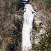
 Lower Whitewater Falls Hike
4.3 mi 6.9 km • 843' Up 257.09 m Up • 844' Down 257.11 m Down
Walhalla, SC
Denton Creek Falls
2.0 mi 3.2 km • 482' Up 146.96 m Up • 482' Down 146.85 m Down
Hiawassee, GA
Double Spring Gap Climb
10.0 mi 16.2 km • 2,388' Up 727.75 m Up • 2,388' Down 727.8 m Down


0 Comments