
 Continue with onX Maps
 Continue with Facebook


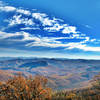
 Particularly Special Place


 Intermediate
Intermediate
Intermediate
 Intermediate
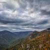
 Linville Gorge Wilderness Loop
21.9 mi 35.2 km • 4,723' Up 1439.6 m Up • 4,722' Down 1439.31 m Down

 Glen Al…, NC
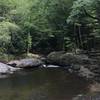
 Linville Falls Full Tour
4.7 mi 7.6 km • 953' Up 290.58 m Up • 938' Down 285.8 m Down
Spruce…, NC
Wet'n'Wild Harper Creek Loop
16.5 mi 26.6 km • 2,644' Up 805.83 m Up • 2,628' Down 800.97 m Down
Linville, NC
Mount Mitchell
11.7 mi 18.8 km • 3,651' Up 1112.72 m Up • 3,650' Down 1112.62 m Down
Black M…, NC
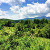
Graybeard/Harry Bryan/Julia Woodward Loop
1.3 mi 2.1 km • 275' Up 83.9 m Up • 277' Down 84.46 m Down
Green Knob Trail
2.1 mi 3.4 km • 464' Up 141.53 m Up • 463' Down 141.17 m Down
Blowing…, NC


0 Comments