
 Continue with onX Maps
 Continue with Facebook


 Particularly Special Place


 Intermediate

 Intermediate
Land Manager: USFS - Pikes Peak Ranger District
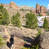
 Lost Creek Lasso via Twin Eagles
38.9 mi 62.7 km • 6,904' Up 2104.38 m Up • 6,887' Down 2099.06 m Down
Bailey, CO
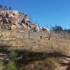
 Dome Rock Loop Trail
10.8 mi 17.4 km • 1,590' Up 484.7 m Up • 1,583' Down 482.47 m Down
 Cripple…, CO
Buffalo Creek Loops
Cripple…, CO
Buffalo Creek Loops
22.1 mi 35.6 km • 2,502' Up 762.53 m Up • 2,503' Down 763.06 m Down
Deckers, CO
Horsethief Falls
2.9 mi 4.6 km • 639' Up 194.77 m Up • 646' Down 196.89 m Down
Sentinel Point
6.9 mi 11.1 km • 2,737' Up 834.24 m Up • 2,728' Down 831.61 m Down
Devil's Head Lookout
2.7 mi 4.4 km • 887' Up 270.49 m Up • 885' Down 269.84 m Down
Deckers, CO


0 Comments