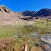
 South Willowbrook Loop
5.0 mi 8.1 km • 805' Up 245.22 m Up • 806' Down 245.74 m Down


 Silvert…, CO
 Buffalo Mountain Loop
13.4 mi 21.6 km • 2,976' Up 907.08 m Up • 2,960' Down 902.3 m Down


 Silvert…, CO
 Ptarmigan Trail (#35)
13.2 mi 21.3 km • 3,536' Up 1077.84 m Up • 3,536' Down 1077.67 m Down


 Silvert…, CO
 Deluge Lake
9.2 mi 14.8 km • 3,390' Up 1033.27 m Up • 3,391' Down 1033.53 m Down


 Vail, CO
 Booth Creek Falls
3.8 mi 6.1 km • 1,302' Up 396.97 m Up • 1,302' Down 396.81 m Down


 Vail, CO
 Gore Range to Wheeler Lakes
7.1 mi 11.4 km • 1,423' Up 433.71 m Up • 1,423' Down 433.75 m Down


 Copper…, CO


0 Comments