
 Continue with onX Maps
 Continue with Facebook


 Particularly Special Place


 Difficult

 Difficult
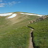
 Byers Peak
8.9 mi 14.3 km • 2,818' Up 859.03 m Up • 2,818' Down 858.96 m Down
 Winter…, CO
 Spruce Creek to Deadhorse Loop Trail
7.5 mi 12.0 km • 1,366' Up 416.29 m Up • 1,389' Down 423.47 m Down
 CDT - Berthoud Pass to Stanley Mountain
7.7 mi 12.4 km • 1,309' Up 398.96 m Up • 1,311' Down 399.68 m Down
Winter…, CO
Grizzly Peak
5.6 mi 9.0 km • 2,381' Up 725.84 m Up • 2,379' Down 725.22 m Down
Keystone, CO
South Fork Loop
3.8 mi 6.2 km • 329' Up 100.29 m Up • 329' Down 100.34 m Down
Fraser, CO
Upper Slate Lake
22.7 mi 36.5 km • 4,091' Up 1247.06 m Up • 4,091' Down 1246.96 m Down
Silvert…, CO


0 Comments