
 Continue with onX Maps
 Continue with Facebook


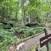
 Particularly Special Place


 Intermediate
Intermediate
Intermediate
 Intermediate
Land Manager: State of Tennessee - Rocky Fork State Park
 Carmen AT Loop
17.0 mi 27.3 km • 3,579' Up 1090.98 m Up • 3,540' Down 1079.07 m Down

 Marshall, NC
 Bald Mountain Creek Preserve Outer Loop
7.3 mi 11.8 km • 1,875' Up 571.35 m Up • 1,878' Down 572.36 m Down
Carvers Gap to Grassy Ridge Bald
4.7 mi 7.5 km • 986' Up 300.52 m Up • 985' Down 300.25 m Down
Roan Mo…, TN
 Mount Mitchell
11.7 mi 18.8 km • 3,651' Up 1112.72 m Up • 3,650' Down 1112.62 m Down
Black M…, NC
Mount Mitchell Challenge
38.9 mi 62.7 km • 5,089' Up 1550.98 m Up • 5,118' Down 1559.93 m Down
Mount Mitchell Vert Marathon
26.6 mi 42.8 km • 9,022' Up 2749.86 m Up • 9,022' Down 2749.76 m Down
Marion, NC


 All Clear


0 Comments