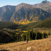
Local Club: Buena Vista Singletrack Coalition
Land Manager: USFS-Pike and San Isabel National Forest - Collegiate Peaks Wilderness
 Mount Antero
14.7 mi 23.7 km • 4,748' Up 1447.07 m Up • 4,746' Down 1446.69 m Down


 Buena V…, CO
 Mt. Princeton
7.2 mi 11.7 km • 3,236' Up 986.28 m Up • 3,235' Down 985.89 m Down


 Buena V…, CO
 MOB Mission: Missouri-Oxford-Belford
15.4 mi 24.8 km • 7,066' Up 2153.67 m Up • 7,068' Down 2154.32 m Down


 Leadvil…, CO
 Lake Ann Out-and-Back
11.2 mi 18.0 km • 1,715' Up 522.76 m Up • 1,715' Down 522.61 m Down


 St. Elmo, CO
 Big Willis Gulch Trail
11.2 mi 18.1 km • 3,016' Up 919.34 m Up • 3,016' Down 919.3 m Down


 Leadvil…, CO
 Black Cloud Trail to Elbert Summit
10.9 mi 17.5 km • 5,023' Up 1531.13 m Up • 5,023' Down 1530.98 m Down


 Leadvil…, CO


0 Comments