
 Continue with onX Maps
 Continue with Facebook


 Particularly Special Place


 Intermediate
Intermediate
Intermediate
 Intermediate
Land Manager: Lakes Region Conservation Trust
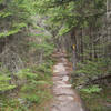
 Mt. Prospect
3.3 mi 5.4 km • 972' Up 296.22 m Up • 970' Down 295.76 m Down

 Plymouth, NH
 Welch-Dickey Mountain Loop
4.2 mi 6.8 km • 1,709' Up 520.84 m Up • 1,709' Down 520.85 m Down
Thornton, NH
 Mt. Chocorua - Piper Trail
8.0 mi 12.9 km • 2,614' Up 796.79 m Up • 2,614' Down 796.73 m Down
Madison, NH
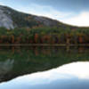
 Echo Lake Trail
0.9 mi 1.5 km • 94' Up 28.6 m Up • 94' Down 28.78 m Down
North C…, NH
Diana's Bath Out and Back
1.1 mi 1.8 km • 83' Up 25.41 m Up • 85' Down 25.82 m Down
North C…, NH
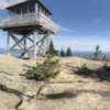
Mount Kearsarge North Trail
5.8 mi 9.4 km • 2,485' Up 757.4 m Up • 2,487' Down 758.04 m Down
North C…, NH


0 Comments