
 Continue with onX Maps
 Continue with Facebook


 Particularly Special Place


 Intermediate

 Intermediate
Land Manager: East Bay Regional Park District (CA)
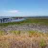
 Richmond Marina Bay Trail
8.1 mi 13.0 km • 23' Up 7.07 m Up • 23' Down 7.05 m Down
 El Cerrito, CA
 10k Loop at Briones
6.9 mi 11.1 km • 773' Up 235.71 m Up • 773' Down 235.61 m Down
Orinda, CA
 Springhill to Lafayette Ridge to Briones Crest to Sunrise to Buckeye
4.0 mi 6.4 km • 978' Up 298.05 m Up • 976' Down 297.48 m Down
Lafayette, CA
Educational Loop
4.3 mi 6.9 km • 622' Up 189.54 m Up • 621' Down 189.4 m Down
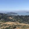
Ring Mountain Loop
2.9 mi 4.6 km • 584' Up 177.96 m Up • 584' Down 178.07 m Down
Corte M…, CA
Mt. Livermore Summit - North Ridge Trail
4.3 mi 6.9 km • 784' Up 239.03 m Up • 783' Down 238.68 m Down
Tiburon, CA


0 Comments