
 Continue with onX Maps
 Continue with Facebook


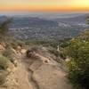
 Particularly Special Place


 Easy/Intermediate
Easy/Intermediate
Easy/Intermediate
 Easy/Intermediate
Land Manager: USFS - Angeles National Forest Office
 Mt. Lowe Summit Loop from Cobb Estate
13.0 mi 20.9 km • 3,796' Up 1157.16 m Up • 3,797' Down 1157.2 m Down

 Three Peak Circuit
7.9 mi 12.7 km • 2,324' Up 708.5 m Up • 2,322' Down 707.7 m Down
 Red Box to San Gabriel Peak
3.9 mi 6.2 km • 1,422' Up 433.39 m Up • 1,422' Down 433.3 m Down
 Altadena, CA
Red Box Trailhead to Valley Forge Campground
Altadena, CA
Red Box Trailhead to Valley Forge Campground
4.9 mi 7.9 km • 1,160' Up 353.42 m Up • 1,157' Down 352.7 m Down
El Prieto to Brown Mountain Loop
8.2 mi 13.2 km • 1,254' Up 382.3 m Up • 1,254' Down 382.32 m Down
La Crescenta: Tee Pee Out and Back
2.9 mi 4.7 km • 1,292' Up 393.75 m Up • 1,292' Down 393.67 m Down
La Caña…, CA


0 Comments