
 Continue with onX Maps
 Continue with Facebook


 Particularly Special Place


 Intermediate

 Intermediate
Local Club: Scrub Oak Scramblers Snowmobile Club (SOSSC)
Jul 1, 2023: 2023-2024 Memberships
 Mt. Chocorua - Piper Trail
8.0 mi 12.9 km • 2,614' Up 796.79 m Up • 2,614' Down 796.73 m Down
 Madison, NH
 Mt. Cutler Loop
2.6 mi 4.2 km • 776' Up 236.67 m Up • 794' Down 241.99 m Down
 Diana's Bath Out and Back
1.1 mi 1.8 km • 83' Up 25.41 m Up • 85' Down 25.82 m Down
North C…, NH
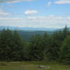
 Devil's Den Mountain
4.1 mi 6.6 km • 461' Up 140.43 m Up • 460' Down 140.22 m Down
Arethusa Falls Out and Back
2.9 mi 4.7 km • 868' Up 264.68 m Up • 869' Down 264.78 m Down
Pemi Loop
30.0 mi 48.2 km • 7,408' Up 2257.85 m Up • 7,402' Down 2256.07 m Down
Lincoln, NH


0 Comments