Hiking Project Logo

A mostly flat, easy desert trail with nice views and a chance to see wild mustangs


Your Rating: Rating Rating Rating Rating Rating      Clear Rating
Your Difficulty:
Your Favorites: Add To-Do · Your List
Zoom in to see details
Map Key

3.5

Miles

5.6

KM

Point to Point

1,894' 577 m

High

1,480' 451 m

Low

83' 25 m

Up

480' 146 m

Down

3%

Avg Grade (2°)

7%

Max Grade (4°)

Dogs Leashed

Features Views · Wildlife

Description

This is a meandering and mostly flat out-and-back trail that should be accessible to most people. There are a few small ravines to descend into and then climb out of—don't worry, the trail is smooth and people do it on bikes all the time.

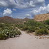
After parking in the lot or otherwise getting to the trailhead, the trail starts out crossing wide washes and gullies. It isn't terribly impressive and feels more like you're in a post-apocalyptic wasteland. To add to that feel, you cross a pit containing old bullet casings, broken glass and other indications of the area's past use as a target-shooting area. Just keep going. It gets much better!

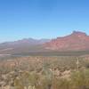
A little over a half mile in is where the trail's personality starts to shine through. This is where you really leave the world behind and can enjoy the day. From here, you really can't hear the cars on the road or the sounds from the shooting range to the south. You can enjoy views of the Salt River and Red Mountain—things are starting to grow back after the fires in 2016 claimed much of the greenery on the north side of the road—but you can still see some evidence of the damage.

Aside from the target shooters, we have mountain bikers to thank for blazing this trail and getting it on the map. It is an enjoyable hike as long as you have planned ahead and brought plenty of water, sunscreen and sun protection. There is not really any shade and things get pretty rough out here in the middle of the summer. In a pinch, you can find a few trees nestled within some little canyons, but they are few and far between. So far, my experiences have been that this trail is not very well-known, although it has had some recent publicity in the news due to the controversy around the wild mustangs, so that may change.

At ~3.5 miles, the Wild Horse Trail trail ends. You have a few options: turn back, head north to an exit on Bush Highway (that exit is part of what is known unofficially as the Twisted Sister trail) or you can continue on the Maricopa Trail connector through some more rugged trails in the Hawes system (adding another ~4-5 miles) and exit further west on Bush Highway near the Granite Reef parking/day use area. Sadly, that area is really popular, so there is usually no available parking, so you have to stage a car early or have someone come pick you up. Tip: über does work out here, but is challenging to get a cell phone signal at this parking area, so you may end up backtracking to be able to make a call.

Flora & Fauna

Aside from the usual Sonoran Desert plants and animals, there are some wild mustangs in this area that you may run across. Be careful as they are wild animals.

Contacts

Shared By:

Doug Baer

Trail Ratings

  3.7 from 3 votes

#23702

Overall
  3.7 from 3 votes
5 Star
33%
4 Star
33%
3 Star
0%
2 Star
33%
1 Star
0%
Trail Rankings

#786

in Arizona

#23,702

Overall
41 Views Last Month
1,711 Since Jan 31, 2018
Easy/Intermediate Easy/Intermediate

50%
0%
50%
0%
0%
0%

Photos

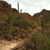
Some crazy Saguaros grow along the Maricopa Trail with Red Mountain in the background.
May 16, 2017 near Fountai…, AZ
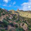
Beautiful views. Sharp cactus.
Jul 19, 2019 near Fountai…, AZ

0 Comments

Weather


Current Trail Conditions

Unknown
Add Your Check-In

Check-Ins

Feb 7, 2021
Michelle F
May 20, 2020
Michelle F
big fleurs
May 18, 2020
Michelle F
Oct 18, 2019
Michelle F
2mi — 1h 30m
Welcome

Join the Community

Create your FREE account today!
Already have an account? Login to close this notice.

Get Started