Hiking Project Logo

This is a pleasant trail along a mid-sized stream that is a major tributary to the Upper Rogue River.


Your Rating: Rating Rating Rating Rating Rating      Clear Rating
Your Difficulty:
Your Favorites: Add To-Do · Your List
Zoom in to see details
Map Key

3.6

Miles

5.8

KM

Point to Point

4,238' 1,292 m

High

3,913' 1,193 m

Low

584' 178 m

Up

284' 87 m

Down

5%

Avg Grade (3°)

23%

Max Grade (13°)

Dogs Off-leash

Features River/Creek · Swimming · Waterfall · Wildflowers

The trail may be closed by snow between November and May. While water is plentiful along the trail, so are cattle during the summer months and water sources could be contaminated. Carry your own water or be prepared to treat and filter water taken from the creek.

Description

The Muir Creek Trail #1042 starts at an undeveloped trailhead just off Highway 230 at the confluence of Muir Creek and the Upper Rogue River. There are no amenities at this trailhead. Note that this trailhead is on the other side of the Upper Rogue River from the Upper Rogue River Trail (#1034).

From the trailhead, the #1042 travels along the west bank of Muir Creek, a mid-sized stream and a major tributary to the Upper Rogue River. The trail passes through Douglas-fir, western white pine, western hemlock, and thickets of box alder along the meandering creek. There are views of high-mountain meadows, wildflowers, old-growth forests, and abundant wildlife.

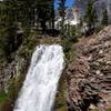
At 2.7 miles from the trailhead, the trail passes a small waterfall/cascade where the East Fork of Muir Creek enters the main creek. At 3.6 miles, the #1042 ends at a junction with the Buck Canyon Trail #1046. This trail can be used to access the upper end of the Muir Creek Trail #1042 from Forest Road 6560-190, which is 0.3 miles to the east.

Near its northern end, the #1042 crosses Off-Highway Vehicle (OHV) Trail #2 - watch for signs keeping you on the #1042, which is closed to OHV traffic.

Flora & Fauna

The early morning hiker may spot elk and deer grazing in the river meadows. Tiger lilies, columbine, and scarlet gilia are common floral vegetation in the moist, open meadows and along the stream banks. Muir Creek is a favorite with flyfishers, as it is generally easy to wade. The fish are generally small wild trout, although occasionally anglers will hook up with a larger fish or two.

Contacts

Shared By:

BK Hope

Trail Ratings

  3.5 from 2 votes

#25011

Overall
  3.5 from 2 votes
5 Star
0%
4 Star
50%
3 Star
50%
2 Star
0%
1 Star
0%
Trail Rankings

#783

in Oregon

#25,011

Overall
6 Views Last Month
766 Since Dec 13, 2017
Easy/Intermediate Easy/Intermediate

50%
0%
50%
0%
0%
0%

Photos

Along Muir Creek
Dec 13, 2017 near Crater…, OR
The cascade on the East Fork of Muir Creek
Dec 13, 2017 near Crater…, OR
Meadows and meanders along Muir Creek
Dec 13, 2017 near Crater…, OR

0 Comments

Weather


Current Trail Conditions

Unknown
Add Your Check-In

Check-Ins

Jul 15, 2021
Miranda & Andy Rommel
This trail was nice - but would be nicer if it was along the water a bit more. LOTS of down trees to climb over & under: difficult for a senior corgi 4mi — 3h 00m
Jun 21, 2020
James Steele
Welcome

Join the Community

Create your FREE account today!
Already have an account? Login to close this notice.

Get Started