
 Continue with onX Maps
 Continue with Facebook


 Particularly Special Place


 Easy
Easy
Easy
Easy
 Easy
Easy
Land Manager: City of San Diego - Parks & Recreation
 Three Peak Out-and-Back
5.8 mi 9.4 km • 1,772' Up 540.24 m Up • 1,772' Down 540.18 m Down
 Cowles Mountain Backside Loop
3.0 mi 4.8 km • 874' Up 266.28 m Up • 877' Down 267.18 m Down
 Slab Loop
4.3 mi 6.9 km • 713' Up 217.29 m Up • 714' Down 217.64 m Down
Lusardi Creek Loop Trail
10.3 mi 16.6 km • 983' Up 299.67 m Up • 968' Down 295.05 m Down
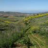
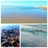
 Tijuana River National Estuary & Coastline
5.4 mi 8.7 km • 30' Up 9.29 m Up • 30' Down 9.29 m Down
Imperia…, CA
 Denk 7
7.6 mi 12.2 km • 1,025' Up 312.37 m Up • 1,021' Down 311.27 m Down


0 Comments