Hiking Project Logo

This is a Swan Creek Wilderness trail.


Your Rating: Rating Rating Rating Rating Rating      Clear Rating
Your Difficulty:
Your Favorites: Add To-Do · Your List
Zoom in to see details
Map Key

4.8

Miles

7.7

KM

Point to Point

1,376' 419 m

High

898' 274 m

Low

496' 151 m

Up

18' 5 m

Down

2%

Avg Grade (1°)

6%

Max Grade (3°)

Dogs Leashed

Features Birding · River/Creek · Wildflowers · Wildlife

Description

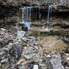
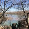
The trailhead begins at a dirt lot on the west side of the area. The trail passes across Swan Creek, which runs year round and is prone to flash flooding. Alternatively, there is a pull-off at the end of the trail at Highway UU if you want to attempt the trail from the other side. This is a dirt path through thick forest that follows generally along the ridgeline. This area is popular for mountain bikers and equestrians, so be alert.

Flora & Fauna

Ticks, snakes, and poison ivy can be found in this area.

Contacts

Shared By:

Missouri Hiker

Trail Ratings

  2.0 from 1 vote

#45347

Overall
  2.0 from 1 vote
5 Star
0%
4 Star
0%
3 Star
0%
2 Star
100%
1 Star
0%
Trail Rankings

#824

in Missouri

#45,347

Overall
2 Views Last Month
283 Since Dec 4, 2017
Intermediate Intermediate

0%
0%
100%
0%
0%
0%

0 Comments

Weather


Current Trail Conditions

Unknown
Add Your Check-In

Check-Ins

Dec 19, 2020
James Wells
We walked this trail out and back with one little side quest. The elevation map on this site is not accurate. There are many more hills and valleys… 10mi — 6h 35m
Welcome

Join the Community

Create your FREE account today!
Already have an account? Login to close this notice.

Get Started