
 Continue with onX Maps
 Continue with Facebook


 Particularly Special Place


 Intermediate/Difficult
Intermediate/Difficult
Intermediate/Difficult
 Intermediate/Difficult
Local Club: New York - New Jersey Trail Conference
Land Manager: NJ State Parks
 Loop around Hank's Pond and beyond Stephens Road.
10.1 mi 16.2 km • 724' Up 220.67 m Up • 721' Down 219.88 m Down
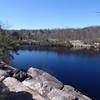
 Butler Reservoir Loop
4.0 mi 6.4 km • 403' Up 122.85 m Up • 401' Down 122.1 m Down
Kinnelon, NJ
Terrace Pond Quick Loop
3.7 mi 5.9 km • 351' Up 107.03 m Up • 351' Down 106.93 m Down
 West Mi…, NJ
 Terrace Pond North - South Loop
10.7 mi 17.2 km • 1,145' Up 348.95 m Up • 1,144' Down 348.58 m Down
High Mountain Preserve Loop
8.1 mi 13.0 km • 980' Up 298.84 m Up • 980' Down 298.83 m Down
North H…, NJ
Sterling Forest Fire Tower Loop
7.4 mi 12.0 km • 1,044' Up 318.25 m Up • 1,044' Down 318.31 m Down


0 Comments