
 Continue with onX Maps
 Continue with Facebook


 Particularly Special Place


 Easy/Intermediate
Easy/Intermediate
Easy/Intermediate
 Easy/Intermediate
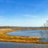
 Jug Bay Tour
6.5 mi 10.5 km • 298' Up 90.69 m Up • 292' Down 89.06 m Down
 Green Loop
2.2 mi 3.5 km • 81' Up 24.61 m Up • 83' Down 25.19 m Down
Perimeter Trail
5.3 mi 8.6 km • 340' Up 103.61 m Up • 343' Down 104.54 m Down
 Berwyn…, MD
Rock Creek Park Loop: Western Ridge to Valley Trails
Berwyn…, MD
Rock Creek Park Loop: Western Ridge to Valley Trails
8.8 mi 14.2 km • 484' Up 147.49 m Up • 485' Down 147.73 m Down
 Valley Trail - Entire Length
5.4 mi 8.6 km • 293' Up 89.24 m Up • 397' Down 121.01 m Down
Fairland Recreation Park
8.5 mi 13.7 km • 507' Up 154.61 m Up • 507' Down 154.59 m Down
Burtons…, MD


0 Comments