
 Continue with onX Maps
 Continue with Facebook


 Particularly Special Place


 Difficult

 Difficult
Land Manager: USFS - White River National Forest Office
 Meadow Mountain Loop
10.3 mi 16.7 km • 2,076' Up 632.85 m Up • 2,076' Down 632.64 m Down
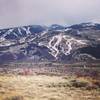
 Grouse Mountain Loop
27.8 mi 44.7 km • 5,745' Up 1751.09 m Up • 5,760' Down 1755.52 m Down
 Beaver Creek Village Lunch Loop Hike
3.1 mi 5.0 km • 638' Up 194.36 m Up • 628' Down 191.56 m Down

 Berry Creek Infiniti Loop
5.7 mi 9.1 km • 1,139' Up 347.06 m Up • 1,151' Down 350.91 m Down
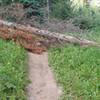
Gore Creek Day Hike
3.6 mi 5.8 km • 735' Up 224.1 m Up • 735' Down 224.06 m Down
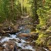
East Lake Creek Out and Back
7.3 mi 11.7 km • 1,427' Up 434.8 m Up • 1,426' Down 434.7 m Down


0 Comments