
 Continue with onX Maps
 Continue with Facebook


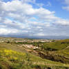
 Particularly Special Place


 Intermediate
Intermediate
Intermediate
 Intermediate
 Ladera Ranch Out-and-Back
13.6 mi 21.8 km • 1,053' Up 320.84 m Up • 1,053' Down 320.84 m Down
 Trabuco Creek Out-and-Back
14.5 mi 23.4 km • 1,074' Up 327.5 m Up • 1,075' Down 327.53 m Down
 Whiting Ranch 20k
13.1 mi 21.1 km • 1,442' Up 439.42 m Up • 1,441' Down 439.31 m Down
Foothil…, CA
James Dilley Preserve Combo
4.7 mi 7.5 km • 540' Up 164.56 m Up • 540' Down 164.51 m Down
 San Clemente Figure 8
17.5 mi 28.1 km • 2,363' Up 720.14 m Up • 2,363' Down 720.14 m Down
Stagecoach South Intermediate Loop
7.8 mi 12.6 km • 958' Up 291.88 m Up • 957' Down 291.78 m Down
Laguna…, CA


0 Comments