
 Continue with onX Maps
 Continue with Facebook


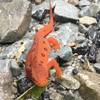
 Particularly Special Place


 Easy
Easy

 Easy
Easy
Land Manager: PaDCNR - Forbes State Forest
 North Woods / LHHT Loop
9.3 mi 15.0 km • 1,527' Up 465.37 m Up • 1,525' Down 464.79 m Down
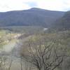
 Tour of Roaring Run
14.9 mi 23.9 km • 2,080' Up 634.06 m Up • 2,079' Down 633.74 m Down
Bear Rocks, PA
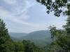
 Laurel Highlands Trail: Ohiopyle State Park
10.5 mi 16.9 km • 2,139' Up 651.88 m Up • 2,139' Down 652.02 m Down
Ohiopyle, PA
Sugarloaf Sled Hill to Falls Overlook
4.6 mi 7.5 km • 78' Up 23.82 m Up • 1,267' Down 386.06 m Down
Ohiopyle, PA


0 Comments