
 Continue with onX Maps
 Continue with Facebook


 Particularly Special Place


 Intermediate
Intermediate
Intermediate
 Intermediate
Land Manager: USFS - San Bernardino National Forest Office
 Big Bear - Champion Lodgepole Pine & Bluff Lake
0.5 mi 0.9 km • 3' Up 1.04 m Up • 97' Down 29.61 m Down

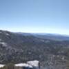
 San Jacinto Peak via Marion Mountain
10.7 mi 17.2 km • 4,159' Up 1267.69 m Up • 4,158' Down 1267.34 m Down
 Idyllwi…, CA
 Deer Springs to Suicide Rock
6.5 mi 10.5 km • 1,799' Up 548.37 m Up • 1,799' Down 548.19 m Down
San Jacinto Peak Loop
22.5 mi 36.2 km • 6,228' Up 1898.26 m Up • 6,231' Down 1899.06 m Down
Idyllwi…, CA
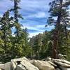
 Round Valley Loop
4.3 mi 6.9 km • 788' Up 240.03 m Up • 792' Down 241.28 m Down
Palm Sp…, CA
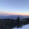
Cactus to Clouds: Palm Springs - Mt. San Jacinto
14.4 mi 23.3 km • 10,444' Up 3183.21 m Up • 172' Down 52.29 m Down
Palm Sp…, CA


0 Comments