Hiking Project Logo

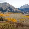
Lots of aspen-filtered views through the La Sal Mountains.


Your Rating: Rating Rating Rating Rating Rating      Clear Rating
Your Difficulty:
Your Favorites: Add To-Do · Your List
Zoom in to see details
Map Key

4.3

Miles

6.9

KM

Point to Point

9,336' 2,846 m

High

8,695' 2,650 m

Low

657' 200 m

Up

940' 287 m

Down

7%

Avg Grade (4°)

25%

Max Grade (14°)

Dogs Unknown

Features Views

Description

This trail traverses the face of the La Sals. It travels through aspen stands with outstanding views back towards Moab and Canyonlands National Park. The trail is not super technical and can be hikeed in either direction, but this is certainly the recommended direction.

It begins with a descent into Brumley Creek. The last 1/4 mile into the creek is very steep and then you'll have a steep 1/4-mile climb back out of the drainage. The trail will then mellow out as you climb towards the highpoint. Once you hit the switchbacks, the trail becomes steep again before gaining a high point on the trail. You'll traverse with a quick 1/4-mile descent before going back to the same contour. After the second highpoint, you'll begin a steep downhill to the La Sal Pass Rd. When the trail becomes really steep look for Squaw Springs. This is a nice stop used by some of the early settlers to the area.

Contacts

Shared By:

Chris Cook

Trail Ratings

  4.0 from 1 vote

#16401

Overall
  4.0 from 1 vote
5 Star
0%
4 Star
100%
3 Star
0%
2 Star
0%
1 Star
0%
Trail Rankings

#584

in Utah

#16,401

Overall
5 Views Last Month
387 Since Sep 18, 2017
Difficult Difficult

0%
0%
0%
0%
100%
0%

Photos

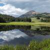
A fenced water source that keeps the cows out. Cool clear water - still recommend using purification. It's just off the trail marked by blue flags.
Aug 17, 2018 near Moab, UT

0 Comments

Weather


Current Trail Conditions

Unknown
Add Your Check-In

Check-Ins

none
Welcome

Join the Community

Create your FREE account today!
Already have an account? Login to close this notice.

Get Started