Hiking Project Logo

John Muir to Emma Carlin connector trail.


Your Rating: Rating Rating Rating Rating Rating      Clear Rating
Your Difficulty:
Your Favorites: Add To-Do · Your List
Zoom in to see details
Map Key

5.0

Miles

8.0

KM

Point to Point

1,041' 317 m

High

901' 275 m

Low

484' 147 m

Up

397' 121 m

Down

3%

Avg Grade (2°)

28%

Max Grade (16°)

Dogs Unknown

Description

Connector - North starts at the northern end of the Bluff Road Two-way Connector above the John Muir Trails. The trail surface varies greatly. From open fields, sandy areas, steep descents, and some rocks, too. Connector - South and Connector - North come together at all road crossings, allowing for bailout if you need to turn back.

Contacts

Land Manager: Wisconsin State Parks

Shared By:

Matt Block

Trail Ratings

  3.5 from 2 votes

#2

in Whitewater

#26312

Overall
  3.5 from 2 votes
5 Star
0%
4 Star
50%
3 Star
50%
2 Star
0%
1 Star
0%
Trail Rankings

#2

in Whitewater

#303

in Wisconsin

#26,312

Overall
2 Views Last Month
144 Since Aug 31, 2017
Intermediate Intermediate

0%
0%
100%
0%
0%
0%

Photos

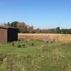
Overlook
May 20, 2019 near Palmyra, WI

0 Comments

Weather


Current Trail Conditions

Unknown
Add Your Check-In

Check-Ins

none
Welcome

Join the Community! It's FREE

Already have an account? Login to close this notice.