
 Continue with onX Maps
 Continue with Facebook


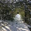
 Particularly Special Place


 Difficult
Difficult
Difficult
 Difficult
Land Manager: NJ DEP - Allamuchy Mountain State Park
 Point Mountain Reservation - North to South
6.4 mi 10.4 km • 1,383' Up 421.62 m Up • 1,071' Down 326.5 m Down


 Stokes State Forest Loop
11.1 mi 17.9 km • 1,107' Up 337.41 m Up • 1,106' Down 337.11 m Down
Rattlesnake Swamp - AT Loop
4.8 mi 7.7 km • 450' Up 137.11 m Up • 452' Down 137.86 m Down
South Stokes Loop
10.7 mi 17.2 km • 1,226' Up 373.72 m Up • 1,225' Down 373.25 m Down
 Mount Tammany and Sunfish Pond Loop
11.6 mi 18.7 km • 2,133' Up 649.99 m Up • 2,156' Down 657.06 m Down
Strouds…, PA
Sunfish Pond via Mt. Tammany Fire Road
10.9 mi 17.5 km • 1,479' Up 450.88 m Up • 1,476' Down 449.94 m Down
Strouds…, PA


0 Comments